On November and December 2020, the Copernicus Assisted Environmental Monitoring across the Black Sea Basin aka PONTOS Project team conducted two online capacity-building training sessions on Shoreline Change Methodology and AquaCrop Model for the core research team. These training sessions are important capacity addition for the PONTOS researchers enhancing the quality and weight of the research they will be conducting in the upcoming months. Apart from these training sessions, the PONTOS team plans a number of training towards the facilitation of its activities related to measurements, retrieval of data, and assessment and analysis. Many of these training activities will be open and targeted to the project’s external stakeholders.
A 2-day training session on Shoreline Change Methodology
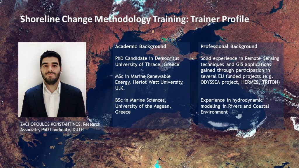
About the Trainer
Mr. Konstantinos ZACHOPOULOS holds an MSc in Marine Renewable Energy and currently, he is a Ph.D. candidate at Laboratory of Ecological Engineering & Technology, Department of Environmental Engineering, School of Engineering, Democritus University of Thrace, Greece.
The Shoreline Change Methodology training was divided into two parts – theoretical and practical. The theoretical session covered such topics as Introduction to coastal erosion, Introduction to Remote Sensing, Open-source databases for satellite images, the methodology applied in a coastal erosion assessment, Satellite image selection, and Shoreline Extraction. While during the second session participants gained practical knowledge on how to use Planet Explorer, Copernicus Open Access Hub, and particularly the theory on the Selection of historical images, Satellite Image downloading, and Shoreline Extraction using the Geographic Information Systems’(GIS) tools.
As coastal erosion is one of the highly growing environmental concerns, faced by coastal communities, and is aggravated by the continuous sea-level rise due to climate change and mismanagement practices, this training provided a special methodology that will be applied in coastal erosion assessments to be conducted by the PONTOS team. The methodology will include the ways to import satellite data from a number of sources, including Earthexplorer, Scihub, Copernicus, and PlanetScope, and import them into the GIS environment to proceed with the analysis.
The trainer further introduced participants to the Digital Shoreline Analysis System (DSAS) tool. This is a crucial capacity for the researchers enabling them to estimate and evaluate the shoreline changes throughout the years.
A 3-day training session on AquaCrop Model
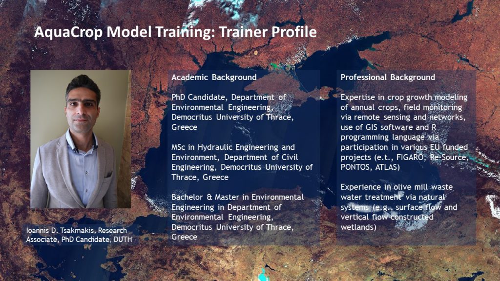
About the Trainer
Mr. Ιoannis Tsakmakis holds a BSc degree in Environmental Engineering, an MSc degree in Hydraulics Engineering and he is currently a Ph.D. Candidate at the Laboratory of Ecological Engineering & Technology Department of Environmental Engineering, School of Engineering, Democritus University of Thrace.
The AquaCrop training aimed at introducing the AquaCrop model to the PONTOS project partners and researchers. AquaCrop is a crop growth model, developed by the Land and Water Division of FAO, to address food security and to assess the effect of environment and management on crop production. The online training session also covered topics on data requirements for model implementation, such as climatic, irrigation, crop, etc. The project team discussed the potential use of the AquaCrop model for the PONTOS project.
During the project implementation, the PONTOS team will obtain precipitation and evapotranspiration data using satellite-borne and Copernicus-based databases. Using indicative soil profiles from national/ international databases, AquaCrop model results will simulate the various water balance components and produce water productivity indicators. Space-borne data will be used to assess the water stress status. The amount of surface water presence and runoff is closely related to the effluents’ amounts reaching the Black Sea.
Joint Operational Programme Black Sea Basin 2014-2020 Copernicus Assisted Environmental Monitoring across the Black Sea Basin – PONTOS
January 2021
Joint Operational Programme Black Sea Basin 2014-2020 is co-financed by the European Union through the European Neighbourhood Instrument and by the participating countries: Armenia, Bulgaria, Georgia, Greece, Republic of Moldova, Romania, Turkey, and Ukraine.
This publication has been produced with the financial assistance of the European Union. The contents of this publication are the sole responsibility of Copernicus assisted environmental monitoring across the Black Sea Basin – PONTOS and can in no way be taken to reflect the views of the European Union.